
Barkas:Solmsschlösschen Wiesbaden.jpg
Resolusi biasa (1.920 × 1.533 piksel, ukuran berkas: 1,72 MB, tipe MIME: image/jpeg)
Ringkesan
| Panyandra |
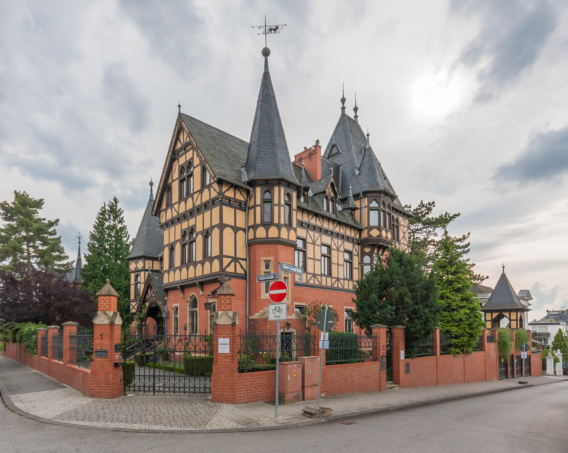
English: Das 1890 bis 1892 erbaute The "Solmsschlösschen" in Wiesbaden has been built between 1890 and 1892 This is a photograph of an architectural monument. It is on the list of cultural monuments of Hessen, no. 0. |
| Tanggal | |
| Sumber | Karya dhéwé |
| Juru pangarang | Martin Kraft |
| Idin (Nganggo manèh barkas iki) |
Reusing this image License: CC BY-SA 3.0 via Wikimedia Commons This image was published by Martin Kraft under the free license CC BY-SA 3.0, which also allows the usage outside of Wikipedia under the following conditions:
Please send me a specimen copy or the URL of the website where the image is used. The Online Attribution Generator offers a good tool to generate an attribution sufficient for your use case. Feel free to contact me via eMail photo@martinkraft.com or visit my website photo.martinkraft.com for any questions or in case you need...
Only the terms and conditions mentioned above authorize the free use of this image. Any infringement causes a copyright violation, that may result in a penalty fee of five times the fee suggested by the MFM, inter alia. |
| Lokasi kamera | | Lihat gambar ini dan gambar di sekitarnya di: OpenStreetMap |
|---|
Jinis lisènsi
- Kowé kena:
- ngedum – nyalin, nyebar, lan ngirim karya
- nyampur – ngolah karya
- Sangisoré kahanan mangkéné:
- atribusi – Kowé kudu mènèhi krédhit kang patut, mènèhi pranala lisènsi, lan kandha yèn ana owah-owahan. Kowé bisa tumindak sasenengmu, nanging ora teges kang duwé lisènsi njurung lakumu.
- andum mèmper – Manawa kowé nyalin rupa, ngowahi, utawa nggawé karya nganggo bahan karya iki, kowé kudu mbabar karyamu kang wis dadi nganggo lisènsi kang padha utawa kang cocog karo karya asliné..

|
Gambar ini diunggah sebagai bagian dari Wiki Loves Monuments 2012.
|
Sajarah kaca
Klik nang tanggal/wektu kanggo ndeleng berkas kiye nang wektu kuwe mau.
| Tanggal/Wektu | Miniatur (''thumbnail'') | Ukuran | Panganggo | Komentar | |
|---|---|---|---|---|---|
| siki | 30 September 2012 12.39 | | 1.920 × 1.533 (1,72 MB) | Martin Kraft | User created page with UploadWizard |
Pranala berkas
Ora ana kaca sing nyambung maring berkas kiye.
Panggunané barkas sajagat
Wiki liya ngisor iki nganggo barkas iki:
- Kanggo ing de.wikipedia.org
- Kanggo ing de.wikivoyage.org
- Kanggo ing www.wikidata.org